|
|
|
|
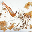
The Smithsonian’s Ocean Portal published an article that describes how scientists are using the In Situ Ichthyoplankton Imaging System (ISIIS) to photograph zooplankton organisms and gather information about salinity, temperature, dissolved oxygen, and light levels.
|
|
|
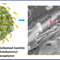
Scientists conducted laboratory experiments using an abundant natural clay material, kaolinite, modified with carbon derived from chitosan as an environmentally friendly alternative to chemical dispersants and visualized resulting phenomena at nanoscale detail.
|
|
|
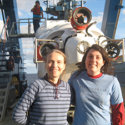
The Gulf of Mexico Research Initiative congratulates Dr. Samantha “Mandy” Joye’s distinction as University of Georgia’s Regents Professor, effective 1 July 2019.
|
|
|
Scientists conducted a time-series investigation of methane concentrations, oxidation rates, and rate constant (the instantaneous capacity of the methanotrophic community to consume methane) to describe methane dynamics after the oil spill.
|
|
|
Posted on May 10, 2018
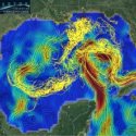
Researchers analyzed how satellite-tracked ocean surface drifters moved in the Gulf of Mexico to learn how other floating materials (oil, plastics, marine organisms) move.
|
|
|
Posted on May 4, 2017
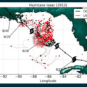
Scientists used GPS data collected from ocean drifters during Hurricane Isaac with a coupled atmosphere-wave-ocean model to better understand how hurricanes affect upper ocean circulation. The researchers found that hurricane-induced Stokes drift (wind-wave-driven water mass transport) created a cyclonic rotational flow to the storm’s left and an anticyclonic rotational flow to its right.
|
|
|
Posted on May 3, 2016
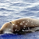
Scientists used passive acoustic monitoring during 2010-2013 to detect the presence of beaked whales in the Gulf of Mexico. These animals are difficult to study visually because they spend little time at the sea surface and are only present in offshore deep waters; they are rarely found on the continental shelf and near-shore waters.
|
|
|
Study Validates Near-Surface Current Mapping Capabilities of Marine X-Band Radar
Near-Surface current mapping by shipboard Marine X-Band Radar: A validation. Lund, B.; Haus, B.K.; Horstmann, J.; Graber, H.C.; Carrasco, R.; Laxague, N.J.M.; Novelli, G.; Guigand, C.M.; Ozgokmen, T.M. Journal of Atmospheric & Oceanic Technology, 2018, 35, 5, 1077–1090
Study Describes STARRS Detailed Imaging of Short-Lived Ocean Surface Dispersion
Surface ocean dispersion observations from the Ship-Tethered Aerostat Remote Sensing System. Carlson, D.F.; Ozgokmen, T.; Novelli, G.; Guigand, C.; Chang, H.; Fox-Kemper, B.; Mensa, J.; Mehta, S.; Fredj, E.; Huntley, H.; Kirwan Jr., A.D.; Berta, M.; Rebozo, M.; Curcic, M.; Ryan, E.; Lund, B.; Haus, B.; Molemaker, J.; Hunt, C.; Chen, S.; Bracken, L.; Horstmann, J. Frontiers in Marine Science, 2018, 5, Article 479
|
|
A meteorology database of Hurricane Patricia's remnants along the Northern Gulf Coast -- data link
Polycyclic aromatic hydrocarbon (PAH) data from reef fish collected at natural reefs sites in the northern Gulf of Mexico from 2015-08-30 to 2017-11-02 -- data link
Underway measurements from the R/V F.G. Walton Smith cruise WS16015 during the LASER experiment in the Gulf of Mexico from 2016-01-15 to 2016-02-14 -- data link
|
|
Synthesis Webinars for Core Area 7 Integrated / Linked Modeling System
GoMRI Synthesis Core Area 7B is developing a conceptual modeling framework that will synthesize new knowledge gained since Deepwater Horizon and set the foundation for a model that addresses broad stakeholder questions for future spills. The model will have to integrate natural and anthropogenic systems at various disciplines and scales. These webinars will gather information from the GoMRI research community. More details, including webinar links, are available here.
- May 20 10 - 11 am ET: Socio-Economics: Moderator Katya Wowk. Speakers TBD.
- May 28 10 - 11 am ET: Physics: Moderators Cecelie Mauritzen and Eric Chassignet. Speakers: William Dewar, Florida State University, Deep oil spills from the first kilometer to the last kilometer and whatever is in between; Deborah French-McCay, RPS ASA (formerly Applied Science Associates) Modeling oil transport, fate, and exposure for evaluation of environmental impacts; and Michael Stukel, Florida State University (title TBD).
Call for Session Proposals: 2020 Gulf of Mexico Oil Spill & Ecosystem Science Conference
June 21, 2019 is the deadline to submit a GoMOSES session proposal. The conference Executive Committee will select sessions to reflect a balance of programmatic goals, including basic science, applied research, topic-specific synthesis, and interdisciplinary efforts. Strong consideration will be given to proposals that seek to identify knowledge gaps for future research. Submit session proposals here.
Now Available! GRIIDC Guidance on Marine/Environmental Chemistry Dataset Submission
This document provides information for successful submissions of environmental/marine chemistry data, which comes in various forms, such as measurements of particulates, dissolved organic carbon, proteins, polycyclic aromatic hydrocarbons, trace metals, nutrients, gasses, anions like sulfides, radioactivity, and other biomolecules in the water column and sediments.
June 5 Deadline: $2.5 M for Gulf Research Program's Loop Current Studies
Submit grant applications for Fostering Innovation to Improve Understanding and Prediction of the Gulf of Mexico Loop Current System, which is part of the larger study Understanding Gulf Ocean Systems. The solicitation's focus is to support innovative theories, technologies, or methodologies that build upon the existing understanding of Loop Current System dynamics and help improve forecasting capabilities of the Loop Current and its associated eddies.
|
|
|
|
|
|
|